Pre-Purchase Flood Risk Assessment — What a "High" Surface Water Rating Really Meant

The challenge
The buyer's solicitor search came back with an Environment Agency rating of High for surface water flooding of the land around the house — a greater than 1 in 30 chance in any year — and the flood map showed water against the walls in every design event. No flooding had ever been reported. The seller said nothing about it. The buyer needed to know whether that rating was a mapping artefact on a flat village green or a real problem, and what it meant for a house he was about to commit to.
What we did
A pre-purchase assessment is different from a planning FRA: there is no development to justify, only a decision to inform. So we set out to explain the mechanism, not just repeat the rating.
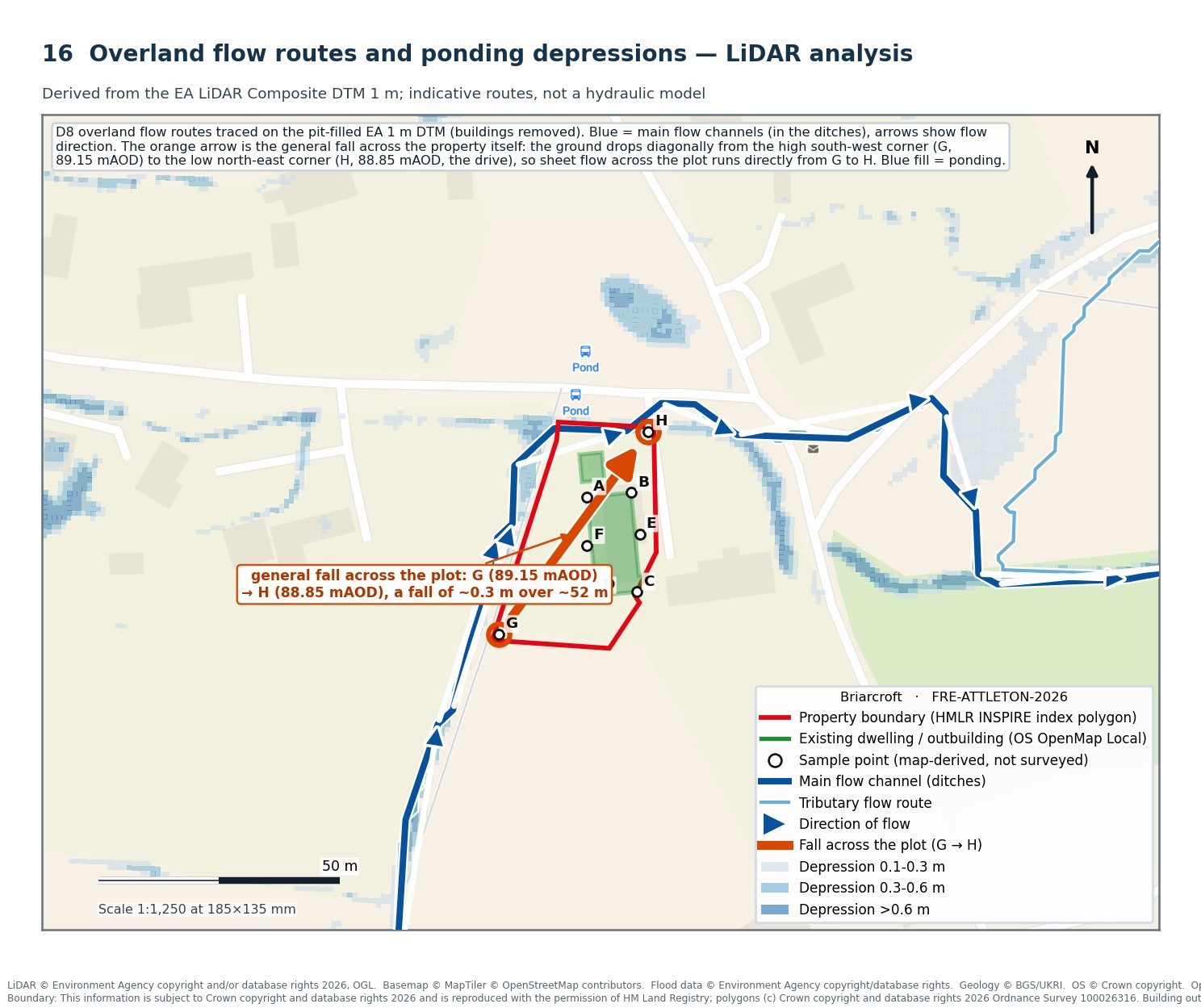
The Environment Agency's LiDAR terrain model showed why the rating is what it is. The hamlet sits on a flat plateau of glacial clay at about 89 m AOD, where rain runs off rather than soaking in, and about 13 hectares of fields drain towards the green. In a severe storm the whole green — the road junction, the pond and the ditches — ponds to a common level before it can escape down the lane. It is that ponded level, not a flowing channel through the plot, that reaches the house.
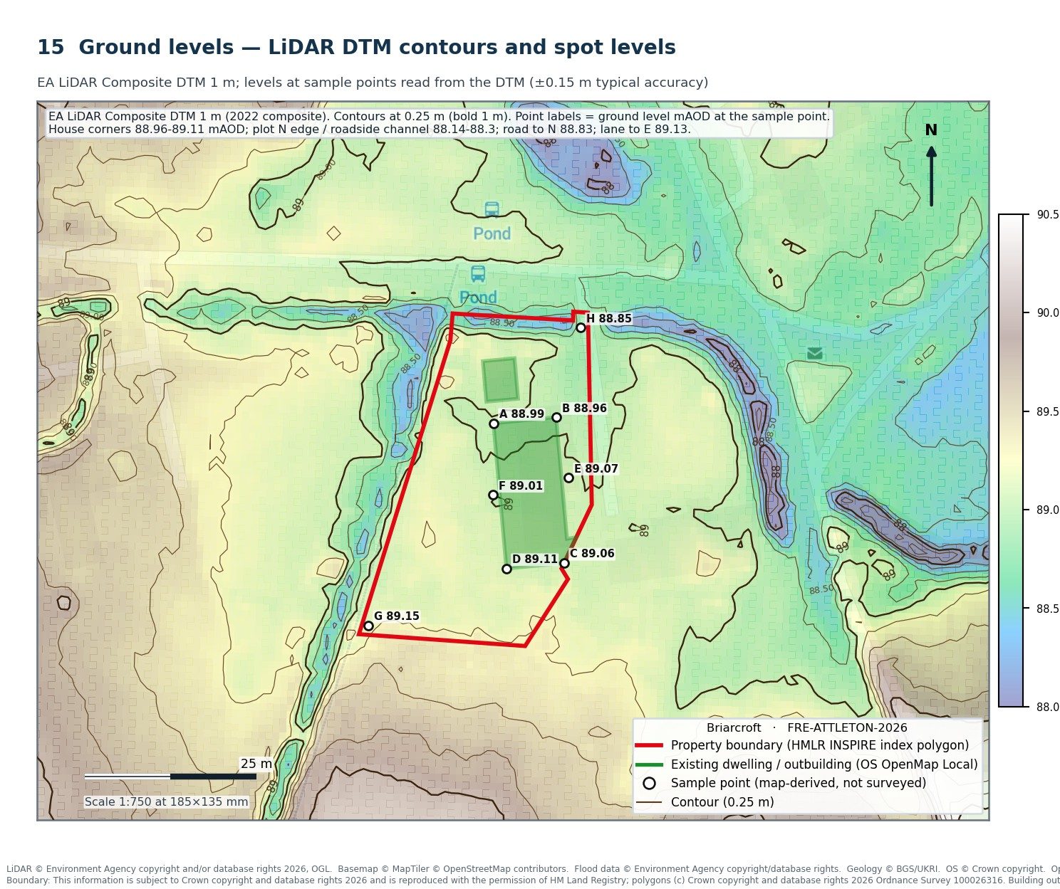
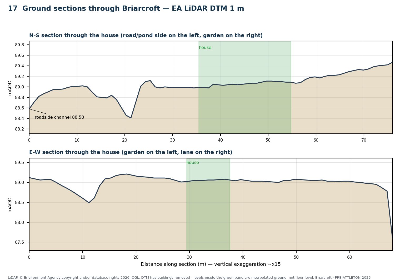
The decisive number was the floor level, and the architect's measured plans gave it to us: 89.235 mAOD, about 235 mm above the external ground. Against ponded levels of roughly 89.3–89.4 mAOD in the 1 in 30 year event and 89.4–89.5 mAOD in the 1 in 100 year event with climate change, water is modelled standing about 65–165 mm above the floor in the more frequent event and 165–265 mm above it in the design event. The ground floor is a solid slab with no airbricks, so the door thresholds are the only way in and there is no sub-floor void to fill.
We rated the risk of water entering the dwelling as Medium — real, but shallow, well understood and manageable — and set out what to do about it: threshold-level flood doorsets and a resilience specification that would take the house comfortably above the design level, the questions to put to the seller's Property Information Form, the neighbours and the Lead Local Flood Authority, and how to approach insurance. The house predates 2009, so it should qualify for Flood Re; we recommended quotations in the buyer's own name, disclosing the rating, before exchange.
The outcome
A 70-page report delivered in five working days for a fixed fee of £350, giving the buyer, his lender and his insurer a quantified answer rather than a colour on a map. He went into the purchase knowing the mechanism, the depth, the measures and the cost — which is exactly what a pre-purchase assessment is for.
If you are buying a property with a flood flag. A search result or an Environment Agency rating tells you the land is at risk; it does not tell you whether water would get into the house, how deep, or what it would cost to prevent. A desk-based pre-purchase assessment answers those questions before you exchange, usually within a week.
Related services
All Services & Resources
Everything you need for flood risk, drainage and environmental planning consultancy across England and Wales.
Flood Risk
Drainage
Other Services
Areas Covered
Frequently Asked Questions
Need a Flood Risk or Drainage Consultant?
Planning-ready FRAs and SuDS drainage strategies across England and Wales. Free quote within 24 hours.
Get a Free QuoteOr contact us directly: 07826 705389 •