Kitchen Extension Behind a River Flood Embankment — Householder FRA in Flood Zone 3

The challenge
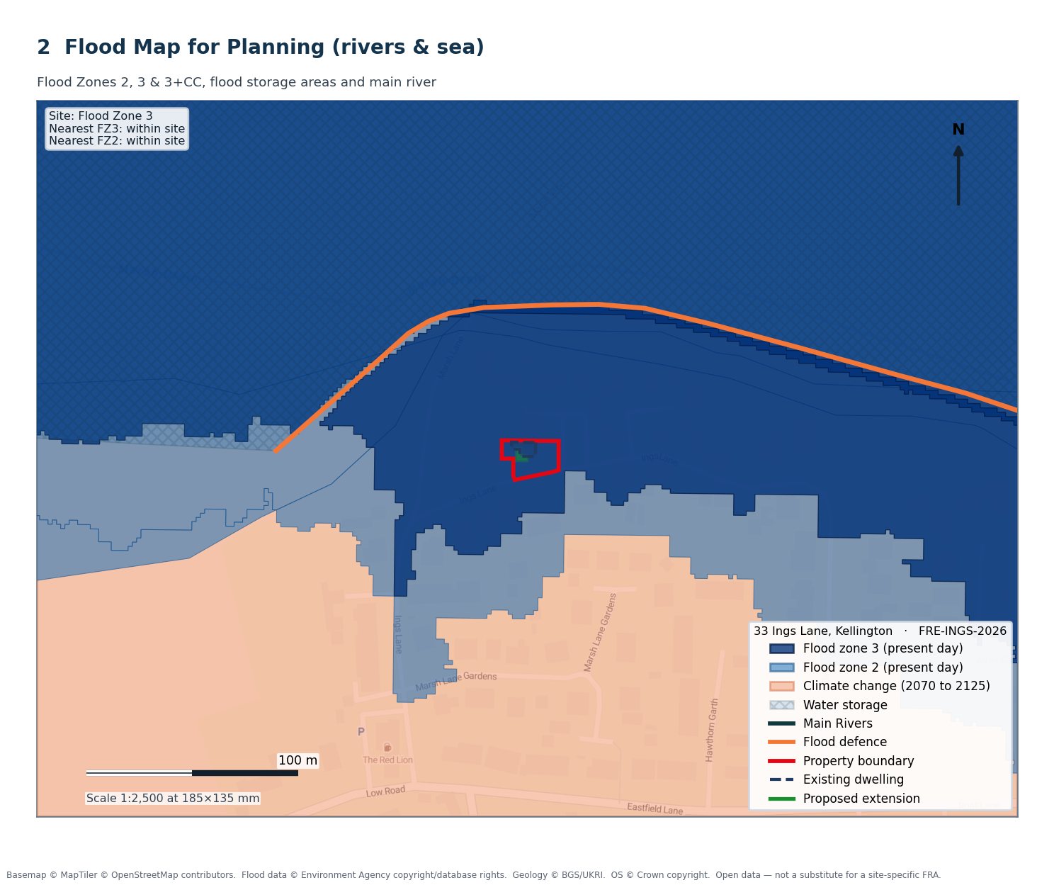
The house sits on the southern edge of the River Aire floodplain, about 100 m south of the raised embankment that keeps the village dry, inside the Environment Agency's flood warning area. The flood map puts it in Flood Zone 3. For a householder extension the sequential and exception tests do not apply and the Environment Agency's standing advice for minor extensions does — but the council still needs an FRA that shows the extension is safe and does not increase flood risk elsewhere. The extension floor has to match the existing house, so it cannot be raised; the mitigation has to come from the construction.
What we did
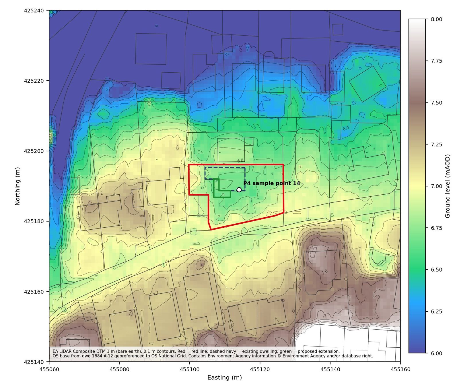
Open flood maps do not give levels, and levels are what this assessment turns on, so we requested the Environment Agency's flood risk assessment data pack for the site. It came from the 2017 Lower Aire study and gave modelled flood levels at a point within the footprint of the house for a range of events with and without the embankment.
With the embankment in place the site does not flood in any present-day event up to the 1 in 200 year; it floods only in the 1 in 1,000 year event, to 8.16 mAOD. With climate change, the defended 1 in 100 year event reaches the site at 7.70, 7.86 and 8.05 mAOD for the +20%, +30% and +50% peak flow runs. Applying the Environment Agency's guidance for a More Vulnerable use in Flood Zone 3a, we adopted the +30% run as the design case — a design flood level of 7.86 mAOD, 1.16 m above ground and 0.86 m above the finished floor — and tested the upper-end +51% allowance as a sensitivity.
Because the floor cannot be raised, the extension is designed to resist and then recover. Flood resistance to 600 mm above the finished floor — a certified flood doorset and self-closing airbricks — keeps water out of the more frequent events; flood resilient construction of the whole extension up to 8.16 mAOD, the design level plus 300 mm, means that if water does get in the fabric dries out rather than being replaced. There is no ground-floor sleeping accommodation and the first floor is a refuge above even the 1 in 1,000 year plus climate change level.
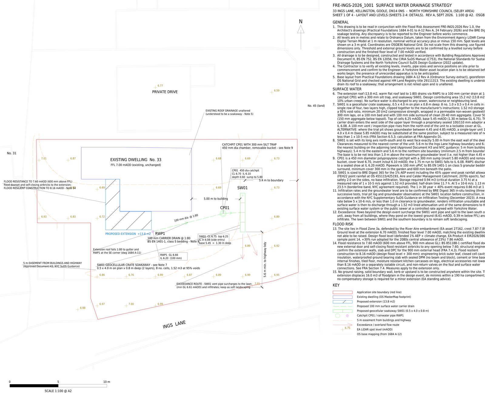
The other question the council asks is whether the extension makes flooding worse for anyone else. We calculated the floodplain volume the new footprint displaces in the design event — 16.0 m³ — and set it against the modelled flood compartment behind the embankment of some 190 ha. The effect is below the resolution of the Environment Agency's model, and its standing advice for minor extensions does not require compensatory storage. Roof water from the extension drains to a new soakaway so that no runoff leaves the site.
The outcome
A householder FRA that answers the two questions the council and the Environment Agency actually ask — is it safe for its lifetime, and does it increase risk elsewhere — with modelled levels, a design event chosen and justified, a resistance and resilience specification the builder can price, and a drainage drawing, all for a fixed fee. The application went in complete.
If you are extending a house in Flood Zone 2 or 3. Even a small extension needs an FRA the council can rely on, and in a defended area that means obtaining the Environment Agency's modelled levels rather than working from the map. It is usually a fixed fee and a couple of weeks, and it avoids the refusal or the 'further information' letter that stalls so many householder applications.
Related services
All Services & Resources
Everything you need for flood risk, drainage and environmental planning consultancy across England and Wales.
Flood Risk
Drainage
Other Services
Areas Covered
Frequently Asked Questions
Need a Flood Risk or Drainage Consultant?
Planning-ready FRAs and SuDS drainage strategies across England and Wales. Free quote within 24 hours.
Get a Free QuoteOr contact us directly: 07826 705389 •